| Location |
| City: | | Valdosta, Georgia, United States |
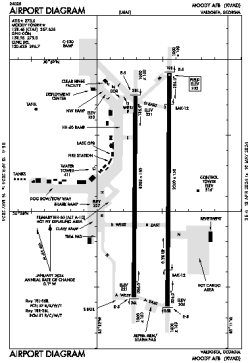
| Name: | Moody AFB |
| ICAO / IATA: | KVAD / VAD |
| FAA: | VAD |
Details |
| Type: | Airport (Airfield) |
| Use: | Military |
| Latitude: | 30°58'07"N (30.968703) |
| Longitude: | 83°11'35"W (-83.192966) |
| Datum: | WGS 1984 |
| Elevation: | 233 ft (71 m) |
| Runways: | 2 |
| Longest: | 9300 × 150 ft (2835 × 45.5 m) |
Time |
| Timezone: | UTC+29:08 (DST+32:08) |
| Local Time: | |
Weather |
| METAR: | KVAD | 041412Z 00000KT 1SM BR BKN001 12/12 A3011 RMK AO2A VIS 1/2 RWY18 BKN V SCT SLPNO ALSTG ESTMD $
|
| TAF: | KVAD | 040900Z 0409/0515 05003KT 8000 BR OVC030 QNH3004INS TEMPO 0411/0414 3200 BR BKN003 OVC030 BECMG 0416/0417 VRB04KT 9999 NSW BKN030 OVC150 QNH3005INS BECMG 0501/0502 25004KT 9999 BKN010 BKN070 QNH3008INS BECMG 0505/0506 24002KT 6000 BR BKN010 OVC050 QNH3010INS TX18/0420Z TN11/0409Z
|
Related Locations |
| Nearby: | |
| Farthest: | USL: 11384 mi / 18321 km
Useless Loop, WA, AU |
Find: |
|
Other Information |
Maps:
|
Links:
|
Sources:
|
|