| Location |
| City: | | Wrightstown, New Jersey, United States |
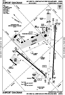
| Name: | McGuire Field (Joint Base McGuire Dix Lakehurst) |
| ICAO / IATA: | KWRI / WRI |
| FAA: | WRI |
Details |
| Type: | Airport (Airfield) |
| Use: | Military |
| Latitude: | 40°00'56"N (40.015584) |
| Longitude: | 74°35'30"W (-74.591698) |
| Datum: | WGS 1984 |
| Elevation: | 140 ft (43 m) |
| Runways: | 2 |
| Longest: | 10014 × 150 ft (3052 × 45.5 m) |
Time |
| Timezone: | UTC+29:08 (DST+32:08) |
| Local Time: | |
Weather |
| METAR: | KWRI | 041356Z 00000KT 10SM CLR 03/03 A3008 RMK AO2A SLP187 T00290029 VISNO RWY06 $
|
| TAF: | KWRI | 041005Z 0410/0516 VRB06KT 0400 FG BKN001 QNH3007INS BECMG 0411/0412 27006KT 4800 BR OVC006 QNH3006INS BECMG 0413/0414 18006KT 9999 NSW FEW006 SCT020 BKN065 QNH2999INS BECMG 0509/0510 22006KT 6000 BR BKN015 QNH2997INS TX07/0418Z TNM03/0506Z
|
Related Locations |
| Nearby: | |
| Farthest: | YAUG: 11773 mi / 18947 km
Augusta [Augusta Airport], WA, AU |
Find: |
|
Other Information |
Maps:
|
Links:
|
Sources:
|
|