| Location |
| City: | | Lafayette, Louisiana, United States |
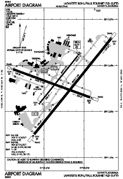
| Name: | Lafayette Regional/Paul Fournet Field |
| ICAO / IATA: | KLFT / LFT |
| FAA: | LFT |
Details |
| Type: | Airport (Part 139 Class I) |
| Use: | Public/Civil |
| Latitude: | 30°12'18"N (30.205028) |
| Longitude: | 91°59'16"W (-91.987749) |
| Datum: | WGS 1984 |
| Elevation: | 41 ft (12 m) |
| Runways: | 3 |
| Longest: | 8000 × 150 ft (2438 × 45.5 m) |
Time |
| Timezone: | UTC+28:08 (DST+31:08) |
| Local Time: | |
Weather |
| METAR: | KLFT | 041353Z VRB03KT 1/4SM FG VV002 18/18 A2998 RMK AO2 SLP151 T01830183
|
| TAF: | KLFT | 041343Z 0414/0512 00000KT 1/2SM FG VCSH VV002 TEMPO 0414/0416 2SM BR OVC005
FM041600 16005KT 5SM BR VCSH OVC007
FM041800 20008KT P6SM VCSH OVC015
FM050200 19003KT 5SM BR OVC005 TEMPO 0508/0512 1/2SM FG VV002
|
Related Locations |
| Nearby: | |
| Farthest: | CCK: 11070 mi / 17816 km
West Island (Pulau Panjang) [Cocos (Keeling) Islands], CC |
Find: |
|
Other Information |
Maps:
|
Delays:
|
Links:
|
Sources:
|
|