| Location |
| City: | | Cincinnati, Ohio, United States |
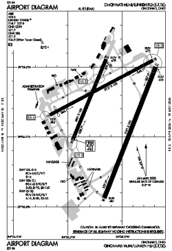
| Name: | Cincinnati Municipal/Lunken Field |
| ICAO / IATA: | KLUK / LUK |
| FAA: | LUK |
Details |
| Type: | Airport (Part 139 Class IV) |
| Use: | Public/Civil |
| Latitude: | 39°06'12"N (39.103333) |
| Longitude: | 84°25'07"W (-84.418610) |
| Datum: | WGS 1984 |
| Elevation: | 483 ft (147 m) |
| Runways: | 3 |
| Longest: | 6101 × 150 ft (1860 × 45.5 m) |
Time |
| Timezone: | UTC+29:08 (DST+32:08) |
| Local Time: | |
Weather |
| METAR: | KLUK | 041353Z 00000KT 8SM FEW100 02/01 A2997 RMK AO2 SLP151 T00170011
|
| TAF: | KLUK | 041145Z 0412/0512 00000KT P6SM SCT250
FM041500 19012KT P6SM SCT025 BKN080
FM041800 19012G20KT P6SM -RA BKN018 OVC070 TEMPO 0420/0422 5SM -RA
FM042200 19011KT P6SM VCSH OVC015
FM050000 20007KT P6SM -RA OVC012
FM050300 22004KT 5SM -RA BR OVC009
FM050700 31003KT 5SM BR VCSH OVC005
|
Related Locations |
| Nearby: | |
| Farthest: | YAUG: 11309 mi / 18200 km
Augusta [Augusta Airport], WA, AU |
Find: |
|
Other Information |
Maps:
|
Links:
|
Sources:
|
|