| Location |
| City: | | Macon, Georgia, United States |
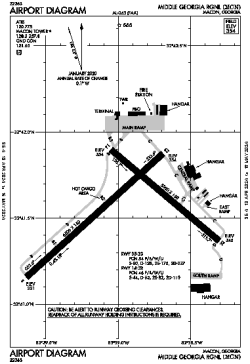
| Name: | Middle Georgia Regional |
| ICAO / IATA: | KMCN / MCN |
| FAA: | MCN |
Details |
| Type: | Airport (Part 139 Class I) |
| Use: | Public/Civil |
| Latitude: | 32°41'34"N (32.692833) |
| Longitude: | 83°38'57"W (-83.649221) |
| Datum: | WGS 1984 |
| Elevation: | 354 ft (108 m) |
| Runways: | 2 |
| Longest: | 6500 × 150 ft (1981 × 45.5 m) |
Time |
| Timezone: | UTC+29:08 (DST+32:08) |
| Local Time: | |
Weather |
| METAR: | KMCN | 041353Z 00000KT 1/4SM FG VV002 07/07 A3011 RMK AO2 SLP196 T00720072
|
| TAF: | KMCN | 041401Z 0414/0512 00000KT 1/4SM FG VV002
FM041600 00000KT P6SM FEW004 SCT015
FM041700 00000KT P6SM SCT025
FM042000 VRB03KT P6SM SCT040 BKN250
FM050700 00000KT P6SM BKN030
FM051000 00000KT 5SM BR BKN020
|
Related Locations |
| Nearby: | |
| Farthest: | MQZ: 11358 mi / 18278 km
Margaret River [Margaret River Airport], WA, AU |
Find: |
|
Other Information |
Maps:
|
Delays:
|
Links:
|
Sources:
|
|