| Location |
| City: | | Atwater, California, United States |
| Near (Alt.): | Merced |
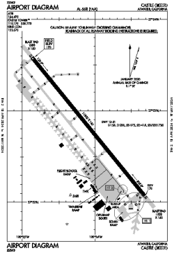
| Name: | Castle Airport |
| ICAO / IATA: | KMER / MER |
| FAA: | MER |
Details |
| Type: | Airport (Airfield) |
| Use: | Public/Civil |
| Latitude: | 37°22'50"N (37.380484) |
| Longitude: | 120°34'05"W (-120.568185) |
| Datum: | WGS 1984 |
| Elevation: | 190 ft (58 m) |
| Runways: | 1 |
| Longest: | 11802 × 150 ft (3597 × 45.5 m) |
Time |
| Timezone: | UTC+26:08 (DST+29:08) |
| Local Time: | |
Weather |
| METAR: | KMER | 041415Z AUTO 18010KT 10SM FEW046 BKN095 09/09 A2962 RMK AO1
|
| TAF: | KMER | 041146Z 0412/0512 13022G28KT P6SM -RA OVC050 TEMPO 0412/0416 2SM RA BR BKN030
FM041900 13015KT P6SM VCTS SCT035 BKN050CB
FM050200 28011G18KT P6SM VCSH BKN050
|
Related Locations |
| Nearby: | |
| Farthest: | FTU: 11312 mi / 18205 km
Tolagnaro [Maurillac Airport (Fort Dauphin Airport)], MG |
Find: |
|
Other Information |
Maps:
|
Links:
|
Sources:
|
|