| Location |
| City: | | Medford, Oregon, United States |
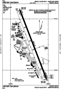
| Name: | Rogue Valley International - Medford |
| ICAO / IATA: | KMFR / MFR |
| FAA: | MFR |
Details |
| Type: | Airport (Part 139 Class I) |
| Use: | Public/Civil |
| Latitude: | 42°22'30"N (42.374965) |
| Longitude: | 122°52'24"W (-122.873287) |
| Datum: | WGS 1984 |
| Elevation: | 1335 ft (407 m) |
| Runways: | 1 |
| Longest: | 8800 × 150 ft (2682 × 45.5 m) |
Time |
| Timezone: | UTC+26:08 (DST+29:08) |
| Local Time: | |
Weather |
| METAR: | KMFR | 041353Z 33003KT 10SM OVC060 02/00 A2938 RMK AO2 RAE42 SLP952 P0000 T00220000
|
| TAF: | KMFR | 041336Z 0414/0512 29007KT P6SM -RA SCT020 OVC040
FM041500 31005KT 5SM -SN BR BKN030
FM041700 33005KT P6SM -SHSN FEW015 SCT025 BKN040
FM050100 30004KT P6SM SCT025 BKN040
|
Related Locations |
| Nearby: | |
| Farthest: | FAME: 11443 mi / 18415 km
Marion Island, Prince Edward Islands, WC, ZA |
Find: |
|
Other Information |
Maps:
|
Delays:
|
Links:
|
Sources:
|
|