| Location |
| City: | | Minot, North Dakota, United States |
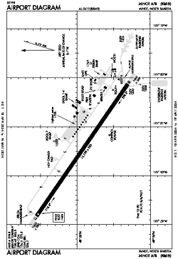
| Name: | Minot AFB |
| ICAO / IATA: | KMIB / MIB |
| FAA: | MIB |
Details |
| Type: | Airport (Airfield) |
| Use: | Military |
| Latitude: | 48°24'57"N (48.415768) |
| Longitude: | 101°21'29"W (-101.358040) |
| Datum: | WGS 1984 |
| Elevation: | 1666 ft (508 m) |
| Runways: | 1 |
| Longest: | 13198 × 300 ft (4023 × 91.5 m) |
Time |
| Timezone: | UTC+28:08 (DST+31:08) |
| Local Time: | |
Weather |
| METAR: | KMIB | 041406Z AUTO 35013G16KT 3SM BLSN OVC023 M23/M27 A3013 RMK AO2 CIG 009 RWY30 SLP265 $
|
| TAF: | KMIB | 040900Z 0409/0515 01012KT 2200 -SN SCT005 OVC015 620159 QNH3002INS BECMG 0412/0413 35012KT 8000 BLSN SCT015 OVC030 620309 QNH3008INS BECMG 0421/0422 02009KT 9999 NSW SCT020 QNH3012INS BECMG 0508/0509 06009KT 6000 -SN SCT010 OVC030 620309 QNH3015INS TXM20/0420Z TNM25/0509Z
|
Related Locations |
| Nearby: | |
| Farthest: | YCSK: 10744 mi / 17292 km
Casey Station [Casey Station Skiway], Wilkes Land, AQ |
Find: |
|
Other Information |
Maps:
|
Links:
|
Sources:
|
|