| Location |
| City: | | Modesto, California, United States |
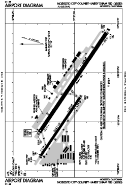
| Name: | Modesto City-County-Harry Sham Field |
| ICAO / IATA: | KMOD / MOD |
| FAA: | MOD |
Details |
| Type: | Airport (Airfield) |
| Use: | Public/Civil |
| Latitude: | 37°37'33"N (37.625825) |
| Longitude: | 120°57'16"W (-120.954429) |
| Datum: | WGS 1984 |
| Elevation: | 99 ft (30 m) |
| Runways: | 2 |
| Longest: | 5904 × 150 ft (1800 × 45.5 m) |
Time |
| Timezone: | UTC+26:08 (DST+29:08) |
| Local Time: | |
Weather |
| METAR: | KMOD | 041353Z 15013G20KT 10SM -RA BKN046 OVC080 09/08 A2956 RMK AO2 RAE01B31 SLP011 P0000 T00940078 $
|
| TAF: | KMOD | 041132Z 0412/0512 15014G22KT P6SM -SHRA SCT025 OVC045 TEMPO 0412/0416 4SM SHRA BKN025
FM041700 23012G19KT P6SM -SHRA OVC050
|
Related Locations |
| Nearby: | |
| Farthest: | FTU: 11314 mi / 18208 km
Tolagnaro [Maurillac Airport (Fort Dauphin Airport)], MG |
Find: |
|
Other Information |
Maps:
|
Delays:
|
Links:
|
Sources:
|
|