| Location |
| City: | | Madison, Wisconsin, United States |
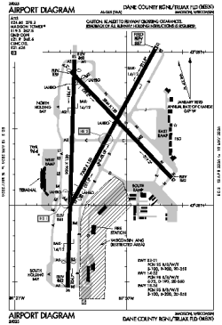
| Name: | Dane County Regional/Truax Field |
| ICAO / IATA: | KMSN / MSN |
| FAA: | MSN |
Details |
| Type: | Airport (Part 139 Class I) |
| Use: | Public/Civil |
| Latitude: | 43°08'24"N (43.139879) |
| Longitude: | 89°20'15"W (-89.337503) |
| Datum: | WGS 1984 |
| Elevation: | 886 ft (270 m) |
| Runways: | 3 |
| Longest: | 9006 × 150 ft (2745 × 45.5 m) |
Time |
| Timezone: | UTC+28:08 (DST+31:08) |
| Local Time: | |
Weather |
| METAR: | KMSN | 041406Z 20007KT 3SM -RA BR OVC006 07/06 A2960 RMK AO2 SFC VIS 4 P0000 T00720061
|
| TAF: | KMSN | 041327Z 0413/0512 19005KT 4SM -RA BR SCT006 BKN012 OVC025 TEMPO 0413/0414 1SM RA BR
FM041700 26011KT P6SM OVC003
FM041900 29012G20KT P6SM OVC008
FM050200 31011KT P6SM SCT070
|
Related Locations |
| Nearby: | |
| Farthest: | YAUG: 10991 mi / 17688 km
Augusta [Augusta Airport], WA, AU |
Find: |
|
Other Information |
Maps:
|
Delays:
|
Links:
|
Sources:
|
|