| Location |
| City: | | Mountain Home, Idaho, United States |
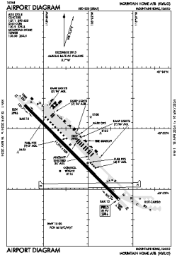
| Name: | Mountain Home AFB |
| ICAO / IATA: | KMUO / MUO |
| FAA: | MUO |
Details |
| Type: | Airport (Airfield) |
| Use: | Military |
| Latitude: | 43°02'37"N (43.043597) |
| Longitude: | 115°52'21"W (-115.872432) |
| Datum: | WGS 1984 |
| Elevation: | 2996 ft (913 m) |
| Runways: | 1 |
| Longest: | 13510 × 200 ft (4118 × 61 m) |
Time |
| Timezone: | UTC+27:08 (DST+30:08) |
| Local Time: | |
Weather |
| METAR: | KMUO | 041358Z 17005KT 10SM CLR 06/M02 A2945 RMK AO2A SLP975 T00591022 $
|
| TAF: | KMUO | 041001Z 0410/0516 12012KT 9999 FEW060 BKN100 510005 QNH2945INS BECMG 0415/0416 12015G25KT 9999 SCT050 BKN060 610609 QNH2947INS BECMG 0418/0419 12015G25KT 9000 -SHRA BKN030 630309 510005 QNH2947INS TEMPO 0419/0423 12020G30KT 8000 -RA OVC020 630209 520009 BECMG 0500/0501 12012G18KT 9000 -SHRA BKN020 OVC080 630209 510003 QNH2936INS BECMG 0502/0503 12009KT 9000 -SHRASN BKN030 630309 QNH2939INS BECMG 0509/0510 VRB06KT 9999 NSW SCT060 BKN080 610809 QNH2946INS BECMG 0515/0516 31009KT 9999 SCT100 QNH2953INS TX09/0421Z TN01/0415Z
|
Related Locations |
| Nearby: | |
| Farthest: | FAME: 11131 mi / 17914 km
Marion Island, Prince Edward Islands, WC, ZA |
Find: |
|
Other Information |
Maps:
|
Links:
|
Sources:
|
|