| Location |
| City: | | Nairobi, Kenya |
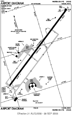
| Name: | Jomo Kenyatta International Airport |
| ICAO / IATA: | HKJK / NBO |
Details |
| Type: | Airport (Aerodrome, Airfield) |
| Use: | Public/Civil, Military |
| Latitude: | 1°19'09"S (-1.319241) |
| Longitude: | 36°55'40"E (36.927775) |
| Datum: | WGS 1984 |
| Elevation: | 5330 ft (1625 m) |
| Runways: | 1 |
| Longest: | 13507 × 148 ft (4117 × 45 m) |
Time |
| Timezone: | UTC+3 (DST+5) |
| Local Time: | |
Weather |
| METAR: | HKJK | 041400Z 06016KT 9999 FEW030 SCT280 28/12 Q1017 NOSIG
|
| TAF: | HKJK | 041100Z 0412/0518 06015KT 9999 FEW028 BECMG 0415/0424 05010KT CAVOK BECMG 0503/0506 33005KT 9999 FEW022 BECMG 0508/0514 06015KT FEW030
|
Related Locations |
| Nearby: | |
| Farthest: | NHV: 11709 mi / 18844 km
Nuku Hiva, Marquesas Islands, PF |
Find: |
|
Other Information |
Maps:
|
Sources:
|
|