| Location |
| City: | | Okinawa, Ryukyu Island, Okinawa, Japan |
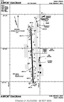
| Name: | Naha Airport / Naha AB |
| ICAO / IATA: | ROAH / OKA |
Details |
| Type: | Airport (Aerodrome, Airfield) |
| Use: | Public/Civil, Military |
| Latitude: | 26°11'45"N (26.195814) |
| Longitude: | 127°38'45"E (127.645869) |
| Datum: | WGS 1984 |
| Elevation: | 12 ft (4 m) |
| Runways: | 1 |
| Longest: | 9840 × 150 ft (2999 × 45.5 m) |
Time |
| Timezone: | UTC+9 (DST+11) |
| Local Time: | |
Weather |
| METAR: | ROAH | 041400Z 06008KT 030V090 9999 FEW012 BKN035 19/15 Q1019 RMK 1CU012 7SC035 A3011
|
| TAF: | ROAH | 041105Z 0412/0518 04008KT 9999 FEW010 BKN020 BECMG 0503/0506 18011KT TEMPO 0503/0506 4000 SHRA
|
Related Locations |
| Nearby: | |
| Farthest: | PTO: 12422 mi / 19991 km
Pato Branco, PR, BR |
Find: |
|
Other Information |
Maps:
|
Sources:
|
|