| Location |
| City: | | Olympia, Washington, United States |
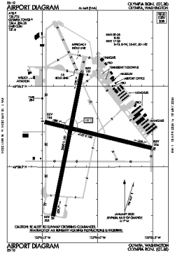
| Name: | Olympia Regional |
| ICAO / IATA: | KOLM / OLM |
| FAA: | OLM |
Details |
| Type: | Airport (Airfield) |
| Use: | Public/Civil |
| Latitude: | 46°58'10"N (46.969404) |
| Longitude: | 122°54'09"W (-122.902544) |
| Datum: | WGS 1984 |
| Elevation: | 207 ft (63 m) |
| Runways: | 2 |
| Longest: | 5500 × 150 ft (1676 × 45.5 m) |
Time |
| Timezone: | UTC+26:08 (DST+29:08) |
| Local Time: | |
Weather |
| METAR: | KOLM | 041354Z AUTO 06008KT 7SM OVC009 M02/M03 A2951 RMK AO2 SLP994 T10171028
|
| TAF: | KOLM | 041253Z 0413/0512 05007KT 5SM -SHSN BR OVC010
FM042100 02006KT 5SM BR BKN025 BKN050
FM050300 VRB03KT P6SM BKN050
|
Related Locations |
| Nearby: | |
| Farthest: | FAME: 11531 mi / 18558 km
Marion Island, Prince Edward Islands, WC, ZA |
Find: |
|
Other Information |
Maps:
|
Links:
|
Sources:
|
|