| Location |
| City: | | Ontario, California, United States |
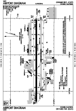
| Name: | Ontario International Airport |
| ICAO / IATA: | KONT / ONT |
| FAA: | ONT |
Details |
| Type: | Airport (Part 139 Class I) |
| Use: | Public/Civil |
| Latitude: | 34°03'22"N (34.056014) |
| Longitude: | 117°36'04"W (-117.601187) |
| Datum: | WGS 1984 |
| Elevation: | 944 ft (288 m) |
| Runways: | 2 |
| Longest: | 12197 × 150 ft (3718 × 45.5 m) |
Time |
| Timezone: | UTC+26:08 (DST+29:08) |
| Local Time: | |
Weather |
| METAR: | KONT | 041412Z 00000KT 6SM -RA BR SCT005 BKN027 OVC050 10/08 A2984 RMK AO2 RAB1355 P0000 T01000083 $
|
| TAF: | KONT | 041329Z 0413/0518 18003KT 5SM -SHRA SCT015 BKN030 TEMPO 0414/0416 2SM RA BKN018
FM041600 09007KT P6SM -SHRA SCT025 OVC035
FM041800 21010KT P6SM -SHRA SCT020 OVC030
FM042000 23014G22KT 4SM -RA SCT015 OVC025
FM050300 26009KT P6SM -SHRA SCT025 BKN035
|
Related Locations |
| Nearby: | |
| Farthest: | ZSE: 11458 mi / 18440 km
St-Pierre (St-Pierre de la Réunion) [Pierrefonds], RE |
Find: |
|
Other Information |
Maps:
|
Delays:
|
Links:
|
Sources:
|
|