| Location |
| City: | | Everett, Washington, United States |
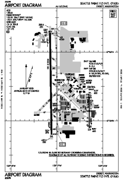
| Name: | Seattle Paine Field International Airport |
| ICAO / IATA: | KPAE / PAE |
| FAA: | PAE |
Details |
| Type: | Airport (Part 139 Class I) |
| Use: | Public/Civil |
| Latitude: | 47°54'26"N (47.907318) |
| Longitude: | 122°16'56"W (-122.282093) |
| Datum: | WGS 1984 |
| Elevation: | 606 ft (185 m) |
| Runways: | 2 |
| Longest: | 9010 × 150 ft (2746 × 45.5 m) |
Time |
| Timezone: | UTC+26:08 (DST+29:08) |
| Local Time: | |
Weather |
| METAR: | KPAE | 041353Z AUTO 28014G19KT 3/4SM R16R/5000V5500FT -SN BR VV006 M05/M06 A2954 RMK AO2 SLP009 P0002 T10501061
|
| TAF: | KPAE | 041131Z 0412/0512 32008G16KT 2SM -SN BR OVC003 TEMPO 0412/0416 1/2SM SN FZFG VV004
FM041600 36008KT 5SM -SN BR BKN015 OVC025
FM042200 36008KT P6SM BKN050
FM050300 01007KT P6SM SCT050
|
Related Locations |
| Nearby: | |
| Farthest: | FAME: 11507 mi / 18519 km
Marion Island, Prince Edward Islands, WC, ZA |
Find: |
|
Other Information |
Maps:
|
Links:
|
Sources:
|
|