| Location |
| City: | | Fairbanks, Alaska, United States |
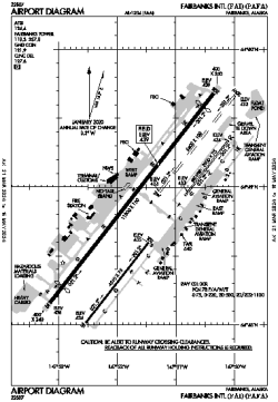
| Name: | Fairbanks International Airport |
| ICAO / IATA: | PAFA / FAI |
| FAA: | FAI |
Details |
| Type: | Airport (Part 139 Class I) |
| Use: | Public/Civil |
| Latitude: | 64°48'55"N (64.815356) |
| Longitude: | 147°51'24"W (-147.856666) |
| Datum: | WGS 1984 |
| Elevation: | 439 ft (134 m) |
| Runways: | 3 |
| Longest: | 11800 × 150 ft (3597 × 45.5 m) |
Time |
| Timezone: | UTC+25:08 (DST+28:08) |
| Local Time: | |
Weather |
| METAR: | PAFA | 041353Z 00000KT 4SM -SN BR BKN010 OVC030 M12/M15 A3005 RMK AO2 SLP189 T11221150 PNO $
|
| TAF: | PAFA | 041140Z 0412/0518 VRB03KT P6SM VCSH SCT015 BKN025 OVC035
FM041500 04004KT P6SM VCSH SCT025 BKN035 OVC050
FM041800 04004KT P6SM SCT035 BKN050 BKN100
FM042100 04004KT P6SM SCT050 SCT100 BKN200
|
Related Locations |
| Nearby: | |
| Farthest: | FAME: 11170 mi / 17977 km
Marion Island, Prince Edward Islands, WC, ZA |
Find: |
|
Other Information |
Maps:
|
Delays:
|
Links:
|
Sources:
|
|