| Location |
| City: | | Plattsburgh, New York, United States |
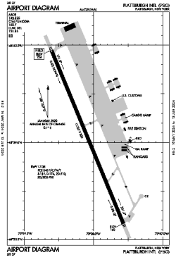
| Name: | Plattsburgh International Airport |
| ICAO / IATA: | KPBG / PBG |
| FAA: | PBG |
Details |
| Type: | Airport (Part 139 Class I) |
| Use: | Public/Civil |
| Latitude: | 44°39'03"N (44.650944) |
| Longitude: | 73°28'05"W (-73.468138) |
| Datum: | WGS 1984 |
| Elevation: | 234 ft (71 m) |
| Runways: | 1 |
| Longest: | 11759 × 200 ft (3584 × 61 m) |
Time |
| Timezone: | UTC+29:08 (DST+32:08) |
| Local Time: | |
Weather |
| METAR: | KPBG | 041353Z AUTO 35004KT 4SM BR SCT030 OVC037 00/M01 A2997 RMK AO2 RAB06E21UPB21E23 SLP152 P0000 T00001011
|
| TAF: | KPBG | 041125Z 0412/0512 17007KT P6SM VCSH OVC030
FM041500 16007KT P6SM OVC015
FM041900 16007KT P6SM OVC008
FM050200 17009G17KT P6SM BKN045
FM050500 17011G21KT 4SM -RA BR OVC050
FM050800 17014G24KT P6SM VCSH OVC025
|
Related Locations |
| Nearby: | |
| Farthest: | YAUG: 11586 mi / 18646 km
Augusta [Augusta Airport], WA, AU |
Find: |
|
Other Information |
Maps:
|
Links:
|
Sources:
|
|