| Location |
| City: | | Portland, Oregon, United States |
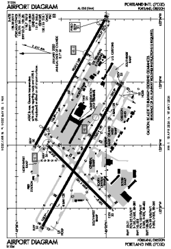
| Name: | Portland International Airport |
| ICAO / IATA: | KPDX / PDX |
| FAA: | PDX |
Details |
| Type: | Airport (Part 139 Class I) |
| Use: | Public/Civil |
| Latitude: | 45°35'19"N (45.588709) |
| Longitude: | 122°35'49"W (-122.596868) |
| Datum: | WGS 1984 |
| Elevation: | 30 ft (9 m) |
| Runways: | 3 |
| Longest: | 11000 × 150 ft (3353 × 45.5 m) |
Time |
| Timezone: | UTC+26:08 (DST+29:08) |
| Local Time: | |
Weather |
| METAR: | KPDX | 041353Z 11006KT 10SM FEW008 SCT013 OVC090 02/02 A2946 RMK AO2 RAE24 SLP974 P0000 T00220017
|
| TAF: | KPDX | 041139Z 0412/0512 12009KT 6SM -SHRASN FEW008 BKN015 OVC035 TEMPO 0414/0418 1SM -SHSN BKN008 OVC020
FM041800 11008KT P6SM -SHSN SCT008 BKN015 OVC030 TEMPO 0418/0422 2SM -SHSN BKN008 OVC015
FM050200 10010KT P6SM VCSH SCT020 BKN045
|
Related Locations |
| Nearby: | |
| Farthest: | FAME: 11501 mi / 18509 km
Marion Island, Prince Edward Islands, WC, ZA |
Find: |
|
Other Information |
Maps:
|
Delays:
|
Links:
|
Sources:
|
|