| Location |
| City: | | Kapolei, Oahu, Hawaii, United States |
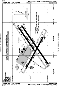
| Name: | Kalaeloa Airport (John Rodgers Field, CGAS Barbers Point) |
| ICAO / IATA: | PHJR / JRF |
| FAA: | JRF |
Details |
| Type: | Airport (Airfield) |
| Use: | Public/Civil |
| Latitude: | 21°18'26"N (21.307354) |
| Longitude: | 158°04'13"W (-158.070301) |
| Datum: | WGS 1984 |
| Elevation: | 30 ft (9 m) |
| Runways: | 3 |
| Longest: | 8000 × 200 ft (2438 × 61 m) |
Time |
| Timezone: | UTC+24:08 (DST+26:08) |
| Local Time: | |
Weather |
| METAR: | PHJR | 041353Z AUTO 05004KT 10SM CLR 19/16 A2994 RMK AO2 SLP144 T01940156 TSNO $
|
| TAF: | PHJR | 041120Z 0412/0512 04004KT P6SM FEW030
FM042000 06009G15KT P6SM SCT040
FM050500 05004KT P6SM FEW035
|
Related Locations |
| Nearby: | |
| Farthest: | GNZ: 12401 mi / 19957 km
Ghanzi [Ghanzi Airport], GH, BW |
Find: |
|
Other Information |
Maps:
|
Links:
|
Sources:
|
|