| Location |
| City: | | Palanga, Lithuania |
| Near (Alt.): | Klaipéda |
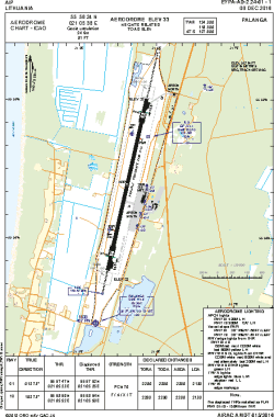
| Name: | Palanga International Airport |
| ICAO / IATA: | EYPA / PLQ |
Details |
| Type: | Airport (Aerodrome, Airfield) |
| Use: | Public/Civil |
| Latitude: | 55°58'24"N (55.973333) |
| Longitude: | 21°05'38"E (21.093889) |
| Elevation: | 33 ft (10 m) |
| Runways: | 1 |
| Longest: | 7480 × 148 ft (2280 × 45 m) |
Time |
| Timezone: | UTC+2 (DST+5) |
| Local Time: | |
Weather |
| METAR: | EYPA | 041420Z 30003KT 240V040 9999 OVC021 00/M03 Q1025 R01/920295
|
| TAF: | EYPA | 032317Z 0400/0424 36006KT 3000 SN BR OVC015 TEMPO 0400/0404 0800 +SN SCT005 BKN010 BECMG 0404/0406 33016KT 5000 B4R BKN020 BECMG 0415/0416 21008KT
|
Related Locations |
| Nearby: | |
| Farthest: | CHT: 11291 mi / 18171 km
Waitangi [Tuuta], CIT, NZ |
Find: |
|
Other Information |
Maps:
|
Links:
|
Sources:
|
|