| Location |
| City: | | Coningsby, Lincolnshire, England, United Kingdom |
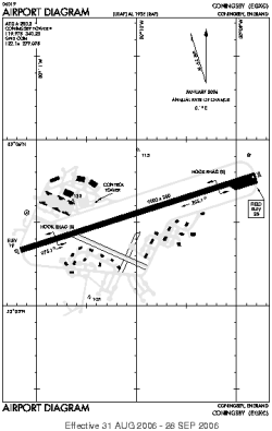
| Name: | RAF Coningsby |
| ICAO / IATA: | EGXC / QCY |
Details |
| Type: | Airport (Aerodrome, Airfield) |
| Use: | Military |
| Latitude: | 53°05'35"N (53.093014) |
| Longitude: | 0°09'58"W (-0.166013) |
| Datum: | WGS 1984 |
| Elevation: | 25 ft (8 m) |
| Runways: | 1 |
| Longest: | 9003 × 200 ft (2744 × 61 m) |
Time |
| Timezone: | UTC+0 (DST+3) |
| Local Time: | |
Weather |
| METAR: | EGXC | 041350Z 25011KT 9999 FEW020 10/06 Q1014 BLU NOSIG
|
| TAF: | EGXC | 041341Z 0415/0509 27010KT 9999 SCT030 BECMG 0422/0501 6000 BR PROB40 0501/0509 0300 FZFG VV///
|
Related Locations |
| Nearby: | |
| Farthest: | NZDC: 11783 mi / 18963 km
Dunedin [City Heliport], OTA, NZ |
Find: |
|
Other Information |
Maps:
|
Links:
|
Sources:
|
|