| Location |
| City: | | Redmond, Oregon, United States |
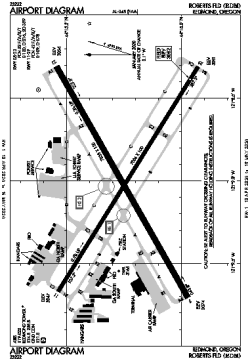
| Name: | Roberts Field |
| ICAO / IATA: | KRDM / RDM |
| FAA: | RDM |
Details |
| Type: | Airport (Part 139 Class I) |
| Use: | Public/Civil |
| Latitude: | 44°15'15"N (44.254069) |
| Longitude: | 121°09'00"W (-121.149970) |
| Datum: | WGS 1984 |
| Elevation: | 3081 ft (939 m) |
| Runways: | 2 |
| Longest: | 7038 × 150 ft (2145 × 45.5 m) |
Time |
| Timezone: | UTC+26:08 (DST+29:08) |
| Local Time: | |
Weather |
| METAR: | KRDM | 041414Z 35003KT 2SM -SN BR OVC028 M01/M03 A2930 RMK AO2 P0000 T10111033
|
| TAF: | KRDM | 041400Z 0414/0512 17006KT 4SM -SN SCT010 OVC040
FM041700 32009KT 2SM -SN BR OVC010 TEMPO 0419/0423 1/2SM SN FG VV005
FM050100 35010KT 5SM -SHSN OVC010
FM050800 30003KT P6SM VCSH OVC010
|
Related Locations |
| Nearby: | |
| Farthest: | FAME: 11409 mi / 18360 km
Marion Island, Prince Edward Islands, WC, ZA |
Find: |
|
Other Information |
Maps:
|
Delays:
|
Links:
|
Sources:
|
|