| Location |
| City: | | Seoul, Korea (Republic of) (South Korea) |
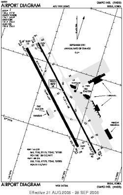
| Name: | Gimpo International (Kimpo International) |
| ICAO / IATA: | RKSS / GMP |
Details |
| Type: | Airport (Aerodrome, Airfield) |
| Use: | Public/Civil |
| Latitude: | 37°33'30"N (37.558311) |
| Longitude: | 126°47'26"E (126.790586) |
| Datum: | WGS 1984 |
| Elevation: | 58 ft (18 m) |
| Runways: | 2 |
| Longest: | 11811 × 148 ft (3600 × 45 m) |
Time |
| Timezone: | UTC+9 (DST+11) |
| Local Time: | |
Weather |
| METAR: | RKSS | 041400Z 31002KT CAVOK M03/M09 Q1026 NOSIG
|
| TAF: | RKSS | 041100Z 0412/0518 16005KT CAVOK TNM05/0422Z TX09/0506Z TEMPO 0503/0508 22010KT BECMG 0516/0517 04005KT 6000 FEW030 BKN150
|
Related Locations |
| Nearby: | |
| Farthest: | SST: 12235 mi / 19690 km
Santa Teresita, B, AR |
Find: |
|
Other Information |
Maps:
|
Sources:
|
|