| Location |
| City: | | San Antonio, Texas, United States |
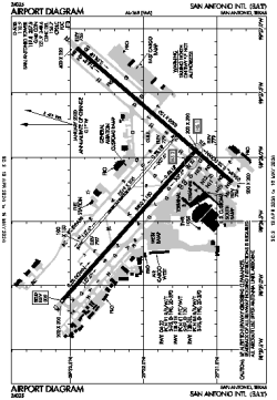
| Name: | San Antonio International Airport |
| ICAO / IATA: | KSAT / SAT |
| FAA: | SAT |
Details |
| Type: | Airport (Part 139 Class I) |
| Use: | Public/Civil |
| Latitude: | 29°32'02"N (29.533958) |
| Longitude: | 98°28'09"W (-98.469056) |
| Datum: | WGS 1984 |
| Elevation: | 809 ft (247 m) |
| Runways: | 3 |
| Longest: | 8505 × 150 ft (2592 × 45.5 m) |
Time |
| Timezone: | UTC+28:08 (DST+31:08) |
| Local Time: | |
Weather |
| METAR: | KSAT | 041351Z 17006KT 3/4SM R13R/P6000FT -DZ BR BKN004 OVC018 19/18 A2990 RMK AO2 TWR VIS 2 SLP111 P0000 T01890178
|
| TAF: | KSAT | 041206Z 0412/0518 19006KT 1SM BR OVC003 TEMPO 0412/0414 1/2SM FG OVC002
FM041500 20004KT 1SM BR OVC006
FM041700 20005KT 4SM BR BKN015
FM041900 19006KT P6SM BKN050 OVC100
FM050600 16005KT 4SM BR BKN008
FM050900 17005KT 1/2SM FG OVC002
FM051300 18005KT 1/4SM FG OVC002
|
Related Locations |
| Nearby: | |
| Farthest: | RRG: 11119 mi / 17894 km
Plaine Corail [Sir Gaëtan Duval Airport (Plaine Corail Airport)], Rodrigues Island, MU |
Find: |
|
Other Information |
Maps:
|
Delays:
|
Links:
|
Sources:
|
|