| Location |
| City: | | San Juan, Puerto Rico, United States |
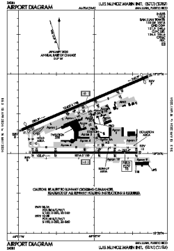
| Name: | Luis Muñoz Marín International (Isla Verde International) |
| ICAO / IATA: | TJSJ / SJU |
| FAA: | SJU |
Details |
| Type: | Airport (Part 139 Class I) |
| Use: | Public/Civil |
| Latitude: | 18°26'22"N (18.439399) |
| Longitude: | 66°00'08"W (-66.002132) |
| Datum: | WGS 1984 |
| Elevation: | 9 ft (3 m) |
| Runways: | 2 |
| Longest: | 10400 × 193 ft (3170 × 59 m) |
Time |
| Timezone: | UTC+30:08 (DST+32:08) |
| Local Time: | |
Weather |
| METAR: | TJSJ | 041356Z 09006KT 10SM FEW030 FEW075 26/21 A3004 RMK AO2 RAB35E45 SLP172 P0000 T02610206
|
| TAF: | TJSJ | 041141Z 0412/0512 11005KT P6SM FEW025
FM041400 09010KT P6SM SCT035
FM041800 08012KT P6SM VCSH FEW025 SCT035
FM042200 10006KT P6SM FEW025 SCT070
|
Related Locations |
| Nearby: | |
| Farthest: | BWB: 12243 mi / 19704 km
Barrow Island, WA, AU |
Find: |
|
Other Information |
Maps:
|
Links:
|
Sources:
|
|