| Location |
| City: | | San Antonio, Texas, United States |
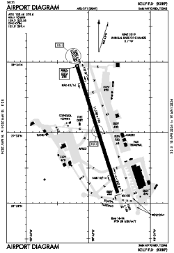
| Name: | Kelly Field (Lackland AFB) |
| ICAO / IATA: | KSKF / SKF |
| FAA: | SKF |
Details |
| Type: | Airport (Airfield) |
| Use: | Public/Civil, Military |
| Latitude: | 29°23'03"N (29.384233) |
| Longitude: | 98°34'52"W (-98.581116) |
| Datum: | WGS 1984 |
| Elevation: | 690 ft (210 m) |
| Runways: | 1 |
| Longest: | 11550 × 150 ft (3520 × 45.5 m) |
Time |
| Timezone: | UTC+28:08 (DST+31:08) |
| Local Time: | |
Weather |
| METAR: | KSKF | 041356Z 15005KT 5/8SM R16/4000V6000FT -DZ BR VV002 19/19 A2989 RMK AO2A SLP118 T01880188 $
|
| TAF: | KSKF | 041000Z 0410/0516 16005KT 1200 BR OVC002 QNH2982INS TEMPO 0410/0414 0400 FG OVC001 BECMG 0416/0417 21008KT 6000 BR BKN007 OVC015 QNH2982INS BECMG 0418/0419 22009KT 9999 NSW SCT009 OVC018 QNH2980INS BECMG 0420/0421 18008KT 9999 SCT015 BKN025 QNH2977INS BECMG 0505/0506 VRB06KT 8000 BR BKN004 OVC015 QNH2986INS TX22/0420Z TN18/0411Z
|
Related Locations |
| Nearby: | |
| Farthest: | RRG: 11130 mi / 17911 km
Plaine Corail [Sir Gaëtan Duval Airport (Plaine Corail Airport)], Rodrigues Island, MU |
Find: |
|
Other Information |
Maps:
|
Links:
|
Sources:
|
|