| Location |
| City: | | Saipan, Northern Mariana Islands, United States |
| Near (Alt.): | Obyan |
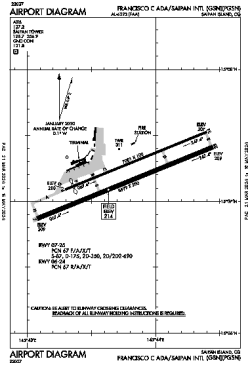
| Name: | Saipan International (Francisco C. Ada) |
| ICAO / IATA: | PGSN / SPN |
| FAA: | GSN |
Details |
| Type: | Airport (Part 139 Class I) |
| Use: | Public/Civil |
| Latitude: | 15°07'13"N (15.120249) |
| Longitude: | 145°43'48"E (145.729986) |
| Datum: | WGS 1984 |
| Elevation: | 214 ft (65 m) |
| Runways: | 2 |
| Longest: | 8699 × 200 ft (2651 × 61 m) |
Time |
| Timezone: | UTC+10 (DST+12) |
| Local Time: | |
Weather |
| METAR: | PGSN | 041418Z 06013G19KT 10SM SCT021 BKN029 BKN034 26/21 A2997 RMK AO2 T02560211 $
|
| TAF: | PGSN | 041120Z 0412/0512 06017G26KT P6SM SCT024 SCT050
|
Related Locations |
| Nearby: | |
| Farthest: | BVM: 12138 mi / 19533 km
Belmonte, BA, BR |
Find: |
|
Other Information |
Maps:
|
Links:
|
Sources:
|
|