| Location |
| City: | | Moscow, Moskovskaya, Russian Federation (Russia) |
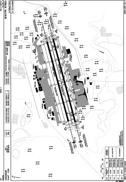
| Name: | Sheremetyevo International Airport |
| ICAO / IATA: | UUEE / SVO |
Details |
| Type: | Airport (Aerodrome, Airfield) |
| Use: | Public/Civil |
| Latitude: | 55°58'21"N (55.972500) |
| Longitude: | 37°24'47"E (37.413056) |
| Elevation: | 630 ft (192 m) |
| Runways: | 2 |
| Longest: | 12139 × 197 ft (3700 × 60 m) |
Time |
| Timezone: | UTC+3 (DST+4) |
Weather |
| METAR: | UUEE | 041400Z 15004G09MPS 4300 BR OVC003 03/02 Q1017 R24L/290051 R24C/290040 NOSIG
|
| TAF: | UUEE | 041350Z 0415/0515 16006MPS 3100 BR OVC003 TX02/0415Z TNM04/0509Z TEMPO 0415/0417 0700 FG VV002 TEMPO 0417/0503 24008G13MPS 1200 SHRASN BKN003 SCT012CB BECMG 0503/0504 30006MPS BKN011 TEMPO 0504/0511 30008G13MPS
|
Related Locations |
| Nearby: | |
| Farthest: | NEMO: 11492 mi / 18494 km
Pacific Ocean [Oceanic Pole of Inaccessibility (Point Nemo)] |
Find: |
|
Other Information |
Maps:
|
Links:
|
Sources:
|
|