| Location |
| City: | | New York, New York, United States |
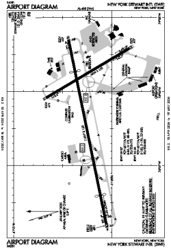
| Name: | New York Stewart International Airport |
| ICAO / IATA: | KSWF / SWF |
| FAA: | SWF |
Details |
| Type: | Airport (Part 139 Class I) |
| Use: | Public/Civil |
| Latitude: | 41°30'15"N (41.504111) |
| Longitude: | 74°06'17"W (-74.104832) |
| Datum: | WGS 1984 |
| Elevation: | 490 ft (149 m) |
| Runways: | 2 |
| Longest: | 11817 × 150 ft (3602 × 45.5 m) |
Time |
| Timezone: | UTC+29:08 (DST+32:08) |
| Local Time: | |
Weather |
| METAR: | KSWF | 041345Z 28006KT 20SM SKC 03/01 A3008
|
| TAF: | KSWF | 041337Z 0414/0518 VRB03KT P6SM SCT250
FM050100 00000KT 6SM BR FEW015 SCT150 OVC250
FM050700 00000KT 5SM BR BKN015 BKN060
FM051500 27006KT P6SM SCT015 SCT250 AMD NOT SKED
|
Related Locations |
| Nearby: | |
| Farthest: | YAUG: 11729 mi / 18877 km
Augusta [Augusta Airport], WA, AU |
Find: |
|
Other Information |
Maps:
|
Delays:
|
Links:
|
Sources:
|
|