| Location |
| City: | | Daegu, Korea (Republic of) (South Korea) |
| Near (Alt.): | Taegu |
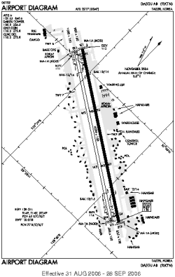
| Name: | Daegu International Airport |
| ICAO / IATA: | RKTN / TAE |
Details |
| Type: | Airport (Aerodrome, Airfield) |
| Use: | Military |
| Latitude: | 35°53'39"N (35.894108) |
| Longitude: | 128°39'32"E (128.658856) |
| Datum: | WGS 1984 |
| Elevation: | 116 ft (35 m) |
| Runways: | 2 |
| Longest: | 9039 × 150 ft (2755 × 45.5 m) |
Time |
| Timezone: | UTC+9 (DST+11) |
| Local Time: | |
Weather |
| METAR: | RKTN | 041400Z 33001KT CAVOK 00/M10 Q1026
|
| TAF: | RKTN | 041100Z 0412/0518 33006KT 9999 SCT040 SCT200 TNM04/0421Z TX10/0506Z
|
Related Locations |
| Nearby: | |
| Farthest: | SUEO: 12273 mi / 19752 km
Montevideo [Montevideo UIR], UY |
Find: |
|
Other Information |
Maps:
|
Sources:
|
|