| Location |
| City: | | Christiansted, St. Croix, Virgin Islands, United States |
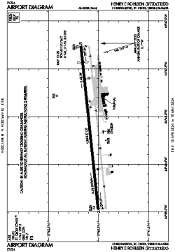
| Name: | Henry E. Rohlsen Airport (Alexander Hamilton International) |
| ICAO / IATA: | TISX / STX |
| FAA: | STX |
Details |
| Type: | Airport (Part 139 Class I) |
| Use: | Public/Civil |
| Latitude: | 17°42'05"N (17.701504) |
| Longitude: | 64°48'07"W (-64.801942) |
| Datum: | WGS 1984 |
| Elevation: | 74 ft (23 m) |
| Runways: | 1 |
| Longest: | 10004 × 150 ft (3049 × 45.5 m) |
Time |
| Timezone: | UTC+30:08 (DST+32:08) |
| Local Time: | |
Weather |
| METAR: | TISX | 041353Z 10010KT 10SM SCT023 28/21 A3004
|
| TAF: | TISX | 041141Z 0412/0512 08008KT P6SM FEW025
FM041400 11013KT P6SM SCT025
FM042200 06006KT P6SM FEW025
|
Related Locations |
| Nearby: | |
| Farthest: | BWB: 12212 mi / 19653 km
Barrow Island, WA, AU |
Find: |
|
Other Information |
Maps:
|
Links:
|
Sources:
|
|