| Location |
| City: | | Tampa, Florida, United States |
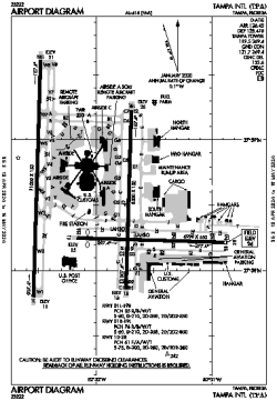
| Name: | Tampa International Airport |
| ICAO / IATA: | KTPA / TPA |
| FAA: | TPA |
Details |
| Type: | Airport (Part 139 Class I) |
| Use: | Public/Civil |
| Latitude: | 27°58'32"N (27.975472) |
| Longitude: | 82°32'00"W (-82.533249) |
| Datum: | WGS 1984 |
| Elevation: | 26 ft (8 m) |
| Runways: | 3 |
| Longest: | 11002 × 150 ft (3353 × 45.5 m) |
Time |
| Timezone: | UTC+29:08 (DST+32:08) |
| Local Time: | |
Weather |
| METAR: | KTPA | 041407Z 06004KT 10SM BKN010 OVC019 18/15 A3008 RMK AO2 CIG 008V011 T01780150
|
| TAF: | KTPA | 041122Z 0412/0518 VRB03KT 3SM BR SCT006 OVC012 TEMPO 0412/0414 1SM BR OVC006
FM041500 08005KT 6SM BR SCT010 BKN020
FM041900 28006KT P6SM FEW030 BKN200
FM050200 VRB03KT P6SM FEW050 SCT200
FM051400 08004KT P6SM FEW050 SCT200
|
Related Locations |
| Nearby: | |
| Farthest: | USL: 11457 mi / 18438 km
Useless Loop, WA, AU |
Find: |
|
Other Information |
Maps:
|
Delays:
|
Links:
|
Sources:
|
|