| Location |
| City: | | Tonopah, Nevada, United States |
| ICAO / IATA: | KTPH / TPH |
| FAA: | TPH |
Details |
| Type: | Airport (Airfield) |
| Use: | Public/Civil |
| Latitude: | 38°03'36"N (38.059894) |
| Longitude: | 117°05'12"W (-117.086600) |
| Datum: | WGS 1984 |
| Elevation: | 5430 ft (1655 m) |
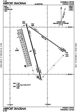
| Runways: | 2 |
| Longest: | 7160 × 75 ft (2182 × 23 m) |
Time |
| Timezone: | UTC+26:08 (DST+29:08) |
| Local Time: | |
Weather |
| METAR: | KTPH | 041408Z AUTO 18020G27KT 10SM FEW021 SCT075 02/M01 A2955 RMK AO2 PK WND 19027/1406 T00171011 $
|
| TAF: | KTPH | 041139Z 0412/0512 18015KT P6SM VCSH FEW015 OVC050
FM041600 17022G32KT P6SM VCSH SCT015 OVC025
FM042100 18022G32KT P6SM SCT030 BKN070
FM050100 18015G25KT P6SM VCSH BKN050 OVC080 TEMPO 0508/0512 4SM -SHSN BR SCT020 OVC035
|
Related Locations |
| Nearby: | |
| Farthest: | ZSE: 11195 mi / 18017 km
St-Pierre (St-Pierre de la Réunion) [Pierrefonds], RE |
Find: |
|
Other Information |
Maps:
|
Links:
|
Sources:
|
|