| Location |
| City: | | Uden, Noord-Brabant (North Brabant), Netherlands |
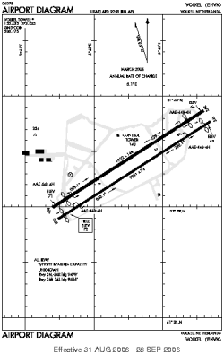
| Name: | Volkel AB |
| ICAO / IATA: | EHVK / UDE |
Details |
| Type: | Airport (Aerodrome, Airfield) |
| Use: | Military |
| Latitude: | 51°39'23"N (51.656389) |
| Longitude: | 5°42'31"E (5.708611) |
| Datum: | WGS 1984 |
| Elevation: | 72 ft (22 m) |
| Runways: | 2 |
| Longest: | 9931 × 74 ft (3027 × 22.5 m) |
Time |
| Timezone: | UTC+1 (DST+4) |
| Local Time: | |
Weather |
| METAR: | EHVK | 041359Z AUTO 19013KT 150V240 9999 SCT037 BKN042 OVC047 04/M01 Q1023 BLU 19013KT 9999 SCT035 BKN040 BECMG 20015G25KT SCT018 BKN020
|
| TAF: | EHVK | 041359Z 0414/0502 21015G27KT 9999 FEW030 OVC035 BECMG 0416/0419 4000 DZRA SCT018 BKN025 PROB30 TEMPO 0418/0423 3000 RA -RASN SCT008 BKN016 BECMG 0423/0502 22008KT SCT008 BKN015
|
Related Locations |
| Nearby: | |
| Farthest: | CHT: 11879 mi / 19117 km
Waitangi [Tuuta], CIT, NZ |
Find: |
|
Other Information |
Maps:
|
Sources:
|
|