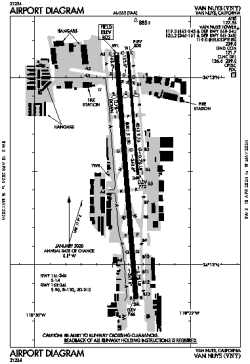
| Location |
| City: | | Van Nuys, California, United States |
| ICAO / IATA: | KVNY / VNY |
| FAA: | VNY |
Details |
| Type: | Airport (Airfield) |
| Use: | Public/Civil |
| Latitude: | 34°12'35"N (34.209806) |
| Longitude: | 118°29'24"W (-118.489971) |
| Datum: | WGS 1984 |
| Elevation: | 802 ft (244 m) |
| Runways: | 2 |
| Longest: | 8001 × 150 ft (2439 × 45.5 m) |
Time |
| Timezone: | UTC+26:08 (DST+29:08) |
| Local Time: | |
Weather |
| METAR: | KVNY | 041351Z 16005KT 10SM FEW019 SCT026 BKN038 10/09 A2980 RMK AO2 RAE1255B39E48 SLP089 P0000 T01000089
|
| TAF: | KVNY | 041419Z 0414/0512 15007KT 6SM -SHRA SCT015 OVC035
FM041600 14015G23KT 6SM -SHRA BKN015 OVC035
FM041800 14015G23KT 4SM RA BR OVC012
FM042200 21008KT 5SM -RA BR SCT012 OVC020
FM050300 17007KT P6SM -SHRA BKN020 OVC030
FM050700 14010KT P6SM -SHRA SCT020 OVC030
|
Related Locations |
| Nearby: | |
| Farthest: | ZSE: 11470 mi / 18460 km
St-Pierre (St-Pierre de la Réunion) [Pierrefonds], RE |
Find: |
|
Other Information |
Maps:
|
Delays:
|
Links:
|
Sources:
|
|