| Location |
| City: | | Camp Douglas, Wisconsin, United States |
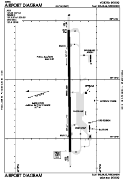
| Name: | Volk Field |
| ICAO / IATA: | KVOK / VOK |
| FAA: | VOK |
Details |
| Type: | Airport (Airfield) |
| Use: | Military |
| Latitude: | 43°56'21"N (43.939240) |
| Longitude: | 90°15'11"W (-90.253161) |
| Datum: | WGS 1984 |
| Elevation: | 912 ft (278 m) |
| Runways: | 1 |
| Longest: | 9000 × 150 ft (2743 × 45.5 m) |
Time |
| Timezone: | UTC+28:08 (DST+31:08) |
| Local Time: | |
Weather |
| METAR: | KVOK | 041356Z 20003KT 3SM BR OVC008 07/07 A2955 RMK AO2A SLP016
|
| TAF: | KVOK | 040900Z 0409/0515 12006KT 1600 BR OVC001 620509 QNH2958INS BECMG 0410/0411 18009KT 1600 BR OVC002 620509 QNH2960INS BECMG 0414/0415 35012G20KT 3200 BR OVC007 620309 QNH2975INS TEMPO 0416/0418 -FZDZ 660002 BECMG 0420/0421 32012G20KT 9999 NSW BKN025 QNH2980INS BECMG 0502/0503 33012KT 9999 SCT010 OVC030 620309 QNH2995INS TX04/0409Z TNM10/0509Z
|
Related Locations |
| Nearby: | |
| Farthest: | YAUG: 10931 mi / 17591 km
Augusta [Augusta Airport], WA, AU |
Find: |
|
Other Information |
Maps:
|
Links:
|
Sources:
|
|