| Location |
| City: | | Vero Beach, Florida, United States |
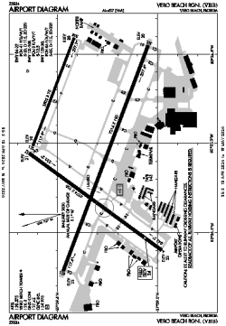
| Name: | Vero Beach Regional |
| ICAO / IATA: | KVRB / VRB |
| FAA: | VRB |
Details |
| Type: | Airport (Part 139 Class I) |
| Use: | Public/Civil |
| Latitude: | 27°39'20"N (27.655555) |
| Longitude: | 80°25'05"W (-80.417953) |
| Datum: | WGS 1984 |
| Elevation: | 23 ft (7 m) |
| Runways: | 3 |
| Longest: | 7314 × 100 ft (2229 × 30.5 m) |
Time |
| Timezone: | UTC+29:08 (DST+32:08) |
| Local Time: | |
Weather |
| METAR: | KVRB | 041353Z 32008KT 10SM OVC006 17/14 A3007 RMK AO2 SLP182 T01670144
|
| TAF: | KVRB | 041321Z 0413/0512 34006KT P6SM OVC009
FM041500 36006KT P6SM SCT010 BKN025
FM041800 03008KT P6SM SCT025 SCT180
FM050000 VRB03KT P6SM SCT150 SCT250
|
Related Locations |
| Nearby: | |
| Farthest: | USL: 11588 mi / 18649 km
Useless Loop, WA, AU |
Find: |
|
Other Information |
Maps:
|
Links:
|
Sources:
|
|