| Location |
| City: | | Baie-Comeau, Québec, Canada |
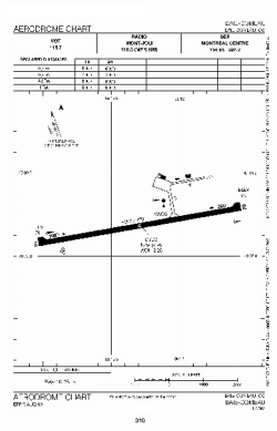
| Name: | Baie-Comeau Airport |
| ICAO / IATA: | CYBC / YBC |
Details |
| Type: | Airport (Airfield) |
| Use: | Public/Civil |
| Latitude: | 49°07'57"N (49.132500) |
| Longitude: | 68°12'16"W (-68.204443) |
| Elevation: | 71 ft (22 m) |
| Runways: | 1 |
| Longest: | 6000 ft (1829 m) |
Time |
| Timezone: | UTC+29:08 (DST+32:08) |
| Local Time: | |
Weather |
| METAR: | CYBC | 041400Z AUTO 27008KT 9SM BKN029 BKN037 OVC050 M08/M09 A2989 RMK SLP126
|
| TAF: | CYBC | 041338Z 0414/0502 30005KT 3SM -SN BKN012 OVC025 TEMPO 0414/0416 P6SM NSW SCT012 OVC025 PROB40 0414/0416 2SM -FZDZ BR
FM041600 28008KT P6SM BKN020 OVC120 TEMPO 0416/0418 SCT020 OVC120
FM041800 28010KT P6SM BKN120
FM042000 27010KT P6SM SCT120 RMK FCST BASED ON AUTO OBS. NXT FCST BY 042000Z
|
Related Locations |
| Nearby: | |
| Farthest: | YDEK: 11411 mi / 18364 km
Denmark, WA, AU |
Find: |
|
Other Information |
Maps:
|
Sources:
|
|