| Location |
| City: | | Campbell River, British Columbia, Canada |
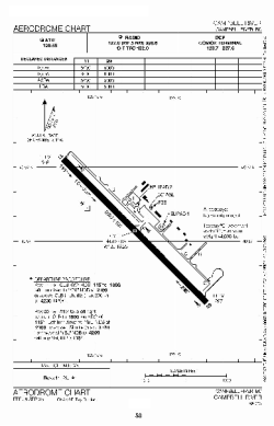
| Name: | Campbell River Airport |
| ICAO / IATA: | CYBL / YBL |
Details |
| Type: | Airport (Airfield) |
| Use: | Public/Civil |
| Latitude: | 49°57'07"N (49.951944) |
| Longitude: | 125°16'23"W (-125.273055) |
| Elevation: | 357 ft (109 m) |
| Runways: | 1 |
| Longest: | 6499 ft (1981 m) |
Time |
| Timezone: | UTC+26:08 (DST+29:08) |
| Local Time: | |
Weather |
| METAR: | CYBL | 041400Z 28009G15KT 15SM FEW110 M08/M16 A2971 RMK AC1 SLP068
|
| TAF: | CYBL | 040038Z 0401/0405 32008KT P6SM -SN SCT012 BKN030 TEMPO 0401/0405 2SM -SHSN OVC010 PROB30 0401/0404 1SM -SHSN RMK NXT FCST WILL BE ISSUED AT 041545Z
|
Related Locations |
| Nearby: | |
| Farthest: | FAME: 11636 mi / 18726 km
Marion Island, Prince Edward Islands, WC, ZA |
Find: |
|
Other Information |
Maps:
|
Sources:
|
|