| Location |
| City: | | Castlegar, British Columbia, Canada |
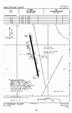
| Name: | West Kootenay Regional Airport |
| ICAO / IATA: | CYCG / YCG |
Details |
| Type: | Airport (Airfield) |
| Use: | Public/Civil |
| Latitude: | 49°17'46"N (49.296111) |
| Longitude: | 117°37'57"W (-117.632499) |
| Elevation: | 1626 ft (496 m) |
| Runways: | 1 |
| Longest: | 5300 × 150 ft (1615 × 45.5 m) |
Time |
| Timezone: | UTC+26:08 (DST+29:08) |
| Local Time: | |
Weather |
| METAR: | CYCG | 041400Z CCA 33014G23KT 6SM -SN BKN031 BKN055 M08/M12 A2967 RMK SC5SC2 /S01 AFT 00Z/ SLP073
|
| TAF: | CYCG | 031838Z 0319/0401 35012KT P6SM BKN040 TEMPO 0319/0324 BKN025
FM040000 34008KT 1SM -SN BKN020 TEMPO 0400/0401 6SM -SN BKN030 RMK NXT FCST WILL BE ISSUED AT 041545Z
|
Related Locations |
| Nearby: | |
| Farthest: | FAME: 11297 mi / 18181 km
Marion Island, Prince Edward Islands, WC, ZA |
Find: |
|
Other Information |
Maps:
|
Links:
|
Sources:
|
|