| Location |
| City: | | Edmonton, Alberta, Canada |
| Near (Alt.): | Nisku |
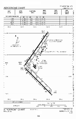
| Name: | Edmonton International Airport |
| ICAO / IATA: | CYEG / YEG |
Details |
| Type: | Airport (Airfield) |
| Use: | Public/Civil |
| Latitude: | 53°18'36"N (53.310000) |
| Longitude: | 113°34'46"W (-113.579443) |
| Elevation: | 2373 ft (723 m) |
| Runways: | 2 |
| Longest: | 10995 ft (3351 m) |
Time |
| Timezone: | UTC+27:08 (DST+30:08) |
| Local Time: | |
Weather |
| METAR: | CYEG | 041400Z 32003KT 6SM -SN BKN075 OVC120 M28/M32 A3018 RMK AC7AC1 VIS NE-SE 3 SLP311
|
| TAF: | CYEG | 041138Z 0412/0512 VRB03KT P6SM -SN OVC080 TEMPO 0412/0415 21/2SM -SHSN VV010
FM041500 VRB03KT P6SM -SN OVC080 TEMPO 0415/0421 4SM -SN FEW020 OVC060
FM042100 12005KT P6SM -SN BKN060
FM050400 12008KT P6SM SCT060 RMK NXT FCST BY 041500Z
|
Related Locations |
| Nearby: | |
| Farthest: | FAME: 11102 mi / 17867 km
Marion Island, Prince Edward Islands, WC, ZA |
Find: |
|
Other Information |
Maps:
|
Links:
|
Sources:
|
|