| Location |
| City: | | Halifax, Nova Scotia, Canada |
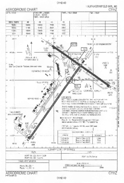
| Name: | Robert L. Stanfield International Airport |
| ICAO / IATA: | CYHZ / YHZ |
Details |
| Type: | Airport (Airfield) |
| Use: | Public/Civil |
| Latitude: | 44°52'47"N (44.879667) |
| Longitude: | 63°30'37"W (-63.510166) |
| Elevation: | 477 ft (145 m) |
| Runways: | 2 |
| Longest: | 10500 × 200 ft (3200 × 61 m) |
Time |
| Timezone: | UTC+30:08 (DST+33:08) |
| Local Time: | |
Weather |
| METAR: | CYHZ | 041400Z 17010G18KT 15SM -SN FEW009 OVC021 M02/M04 A3006 RMK SF2ST6 SLP188
|
| TAF: | CYHZ | 041139Z 0412/0512 18010KT P6SM OVC040 TEMPO 0412/0414 21/2SM -SN OVC020
FM041400 20012KT P6SM OVC015 PROB40 0414/0416 2SM -FZDZ -SN OVC010
FM041700 20012KT 6SM -RA -DZ BR SCT008 OVC012
FM042000 24010KT 6SM BR SCT008 OVC012
FM050200 28005KT 2SM BR SCT004 OVC008
FM051000 14008KT 1/2SM FG VV002 RMK NXT FCST BY 041500Z
|
Related Locations |
| Nearby: | |
| Farthest: | YDEK: 11743 mi / 18898 km
Denmark, WA, AU |
Find: |
|
Other Information |
Maps:
|
Links:
|
Sources:
|
|