| Location |
| City: | | Natashquan, Québec, Canada |
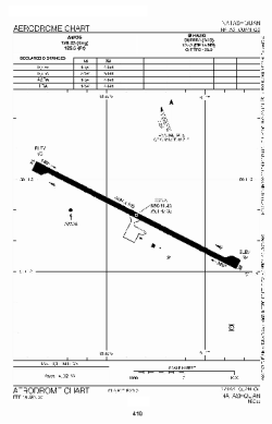
| Name: | Natashquan Airport |
| ICAO / IATA: | CYNA / YNA |
Details |
| Type: | Airport (Airfield) |
| Use: | Public/Civil |
| Latitude: | 50°11'24"N (50.190000) |
| Longitude: | 61°47'20"W (-61.788888) |
| Elevation: | 39 ft (12 m) |
| Runways: | 1 |
| Longest: | 4495 ft (1370 m) |
Time |
| Timezone: | UTC+29:08 (DST+32:08) |
| Local Time: | |
Weather |
| METAR: | CYNA | 041400Z AUTO 19013G19KT 1SM -SN VV015 M08/M10 A2992 RMK SLP135
|
| TAF: | CYNA | 041338Z 0414/0502 19012G22KT 1SM -SN VV010 TEMPO 0414/0417 3SM -SN OVC025 PROB40 0414/0417 1SM -FZDZ BR
FM041700 22010G20KT 2SM -SN OVC020 TEMPO 0417/0420 6SM -SN OVC025 PROB40 0417/0420 1SM -SN VV010
FM042000 33008KT P6SM BKN015 OVC030
FM050000 33008KT P6SM SCT030 RMK FCST BASED ON AUTO OBS. NXT FCST BY 042000Z
|
Related Locations |
| Nearby: | |
| Farthest: | ALH: 11377 mi / 18310 km
Albany, WA, AU |
Find: |
|
Other Information |
Maps:
|
Sources:
|
|