| Location |
| City: | | Lethbridge, Alberta, Canada |
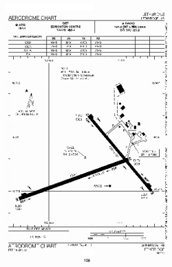
| Name: | Lethbridge County Airport |
| ICAO / IATA: | CYQL / YQL |
Details |
| Type: | Airport (Airfield) |
| Use: | Public/Civil |
| Latitude: | 49°37'49"N (49.630278) |
| Longitude: | 112°47'59"W (-112.799721) |
| Elevation: | 3049 ft (929 m) |
| Runways: | 2 |
| Longest: | 6500 ft (1981 m) |
Time |
| Timezone: | UTC+27:08 (DST+30:08) |
| Local Time: | |
Weather |
| METAR: | CYQL | 041400Z 11004KT 10SM -SN BKN050 M25/M30 A3005 RMK SC7 SLP285
|
| TAF: | CYQL | 041138Z 0412/0424 05005KT P6SM -SN SCT040 OVC090 TEMPO 0412/0424 5SM -SN FEW020 OVC040 RMK FCST BASED ON AUTO OBS. NXT FCST BY 041800Z
|
Related Locations |
| Nearby: | |
| Farthest: | FAME: 11080 mi / 17832 km
Marion Island, Prince Edward Islands, WC, ZA |
Find: |
|
Other Information |
Maps:
|
Links:
|
Sources:
|
|