| Location |
| City: | | Trois-Rivières, Québec, Canada |
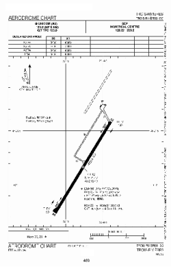
| Name: | Trois-Rivières Airport |
| ICAO / IATA: | CYRQ / YRQ |
Details |
| Type: | Airport (Airfield) |
| Use: | Public/Civil |
| Latitude: | 46°21'06"N (46.351667) |
| Longitude: | 72°40'50"W (-72.680555) |
| Elevation: | 199 ft (61 m) |
| Runways: | 1 |
| Longest: | 9006 ft (2745 m) |
Time |
| Timezone: | UTC+29:08 (DST+32:08) |
| Local Time: | |
Weather |
| METAR: | CYRQ | 041400Z AUTO VRB02KT 6SM BR SCT033 OVC040 M08/M09 A3000 RMK SLP166
|
| TAF: | CYRQ | 041338Z 0414/0502 VRB03KT P6SM BKN025 TEMPO 0414/0424 5SM -SN -FZDZ BR BKN008 OVC020
FM050000 VRB03KT 6SM BR OVC020 TEMPO 0500/0502 5SM -FZRA BR BKN008 RMK FCST BASED ON AUTO OBS. NXT FCST BY 042000Z
|
Related Locations |
| Nearby: | |
| Farthest: | YAUG: 11506 mi / 18518 km
Augusta [Augusta Airport], WA, AU |
Find: |
|
Other Information |
Maps:
|
Sources:
|
|