| Location |
| City: | | Canberra, Australian Capital Territory, Australia |
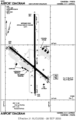
| Name: | Canberra Airport |
| ICAO / IATA: | YSCB / CBR |
Details |
| Type: | Airport (Aerodrome, Airfield) |
| Use: | Public/Civil |
| Latitude: | 35°18'24"S (-35.306666) |
| Longitude: | 149°11'42"E (149.195000) |
| Elevation: | 1886 ft (575 m) |
| Runways: | 2 |
| Longest: | 10771 ft (3283 m) |
Weather |
| METAR: | YSCB | 041400Z AUTO 12005KT 080V160 9999 -SHRA SCT016 BKN035 BKN052 20/20 Q1017 N NW
|
| TAF: | YSCB | 041115Z 0412/0512 12005KT 9999 SCT020
FM050000 11014KT 9999 -SHRA BKN035 BECMG 0511/0512 12012KT 9999 -SHRA BKN020 TEMPO 0413/0420 9999 BKN020 PROB30 TEMPO 0412/0413 VRB20G35KT 2000 TSRA BKN008 SCT060CB PROB30 TEMPO 0504/0510 VRB20G35KT 2000 TSRA BKN020 SCT040CB
|
Related Locations |
| Nearby: | |
| Farthest: | HOR: 12183 mi / 19606 km
Horta (Faial Island), 20, PT |
Find: |
|
Other Information |
Maps:
|
Links:
|
Sources:
|
|