| Location |
| City: | | Richmond, New South Wales, Australia |
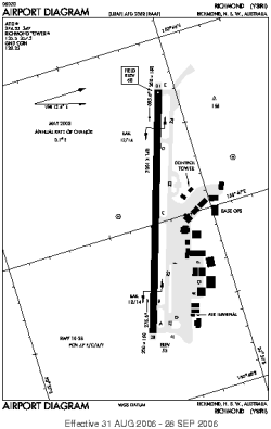
| Name: | RAAF Base Richmond |
| ICAO / IATA: | YSRI / XRH |
Details |
| Type: | Airport (Aerodrome, Airfield) |
| Use: | Military |
| Latitude: | 33°36'02"S (-33.600555) |
| Longitude: | 150°46'51"E (150.780833) |
| Datum: | WGS 1984 |
| Elevation: | 67 ft (20 m) |
| Runways: | 1 |
| Longest: | 7001 × 148 ft (2134 × 45 m) |
Time |
| Timezone: | UTC+10 (DST+13) |
| Local Time: | |
Weather |
| METAR: | YSRI | 041400Z AUTO 19006KT 9999 // NCD 26/19 Q1012 RF00.0/000.0 PRESENT WEATHER SENSOR US
|
| TAF: | YSRI | 041102Z 0412/0512 19007KT 9999 FEW010
FM041400 19005KT 9999 -DZ SCT006 BKN010
FM042300 17010KT 9999 -SHRA BKN020
FM050200 14010KT 9999 -SHRA BKN025
FM050900 VRB05KT 9999 FEW015 BKN030 INTER 0506/0509 6000 SHRA BKN020
|
Related Locations |
| Nearby: | |
| Farthest: | SMA: 12110 mi / 19490 km
Santa Maria, 20, PT |
Find: |
|
Other Information |
Maps:
|
Sources:
|
|