| Location |
| City: | | Trenton, Ontario, Canada |
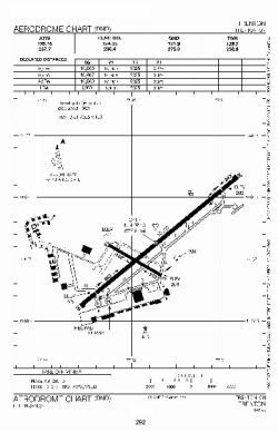
| Name: | CFB Trenton (Trenton Airport) |
| ICAO / IATA: | CYTR / YTR |
Details |
| Type: | Airport (Airfield) |
| Use: | Military |
| Latitude: | 44°07'08"N (44.118889) |
| Longitude: | 77°31'41"W (-77.528055) |
| Elevation: | 283 ft (86 m) |
| Runways: | 1 |
| Longest: | 10000 ft (3048 m) |
Time |
| Timezone: | UTC+29:08 (DST+32:08) |
| Local Time: | |
Weather |
| METAR: | CYTR | 041400Z 28003KT 3SM BR BKN014 OVC030 04/04 A2995 RMK SC6SC2 SLP147
|
| TAF: | CYTR | 041130Z 0412/0512 22008KT 2SM -DZ BR OVC006 TEMPO 0412/0414 6SM BR SCT006 OVC020 PROB30 0412/0414 1/2SM -DZ FG VV002
FM041400 22008KT 3SM BR SCT008 OVC020 TEMPO 0414/0417 P6SM NSW SCT008 OVC025
FM041700 21005KT P6SM FEW008 SCT030 BKN220
FM050000 18005KT P6SM BKN040 OVC130 TEMPO 0500/0503 P6SM -RA OVC030
FM050300 19010KT 5SM -RA BR SCT012 OVC025
FM050500 24012KT 2SM -RA BR BKN005 OVC010
FM050800 25012KT 6SM BR BKN010
FM051000 27012KT P6SM SCT010 RMK NXT FCST BY 041800Z
|
Related Locations |
| Nearby: | |
| Farthest: | YAUG: 11479 mi / 18474 km
Augusta [Augusta Airport], WA, AU |
Find: |
|
Other Information |
Maps:
|
Sources:
|
|