| Location |
| City: | | Timmins, Ontario, Canada |
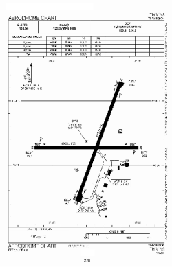
| Name: | Victor M. Power Airport |
| ICAO / IATA: | CYTS / YTS |
Details |
| Type: | Airport (Airfield) |
| Use: | Public/Civil |
| Latitude: | 48°34'14"N (48.570556) |
| Longitude: | 81°22'36"W (-81.376666) |
| Elevation: | 968 ft (295 m) |
| Runways: | 2 |
| Longest: | 6000 ft (1829 m) |
Time |
| Timezone: | UTC+29:08 (DST+32:08) |
| Local Time: | |
Weather |
| METAR: | CYTS | 041400Z 06008KT 10SM -SN FEW015 BKN053 OVC100 M17/M20 A3001 RMK SF1SC5AC2 PRESFR SLP192
|
| TAF: | CYTS | 041338Z 0414/0502 03008KT P6SM -SN SCT020 BKN025 TEMPO 0414/0419 21/2SM -SHSN BKN020 BECMG 0415/0417 07012G22KT
FM041900 07012G22KT 3/4SM -SN VV008
FM042100 07012G22KT 3/4SM -SNPL VV007 PROB30 0421/0424 1/2SM SN
FM050000 03012G22KT 1SM -SN OVC010 BECMG 0500/0502 35008KT 6SM -SN RMK NXT FCST BY 042000Z
|
Related Locations |
| Nearby: | |
| Farthest: | YAUG: 11136 mi / 17921 km
Augusta [Augusta Airport], WA, AU |
Find: |
|
Other Information |
Maps:
|
Links:
|
Sources:
|
|